GRAS helps build sustainable, ethical supply chains using Google Maps APIs and Google Cloud Platform

Today we hear from Dr. Norbert Schmitz, managing director of Meo Carbon Solutions. Read how Meo Carbon Solutions and Google for Work Premier Partner Wabion used Google Maps APIs and Google Cloud Platform to develop Global Risk Assessment Services (GRAS). The tool provides reliable information about the ecological and social risks of expanding agriculture into natural habitats.
In the European Union, companies that sell biofuels must get certifications to show that producing their fuel — often made from agricultural crops — does not cause deforestation, the loss of biodiversity or the loss of carbon stocks. We established GRAS to provide a single tool to gather and visualize this data required to support a credible certification.Through GRAS, we’ve made this information accessible not only to governments and NGOs, but also to businesses, financial institutions and individuals. For example, a U.S. company buying soybean oil from Brazil can use GRAS to verify the ecological and social risk exposure of the mills and the farmers supplying the mills.
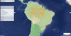
We decided the most effective way to present this complex set of information was to build a web app that would overlay data from multiple sources on top of a map. Using this tool, auditors can compare before-and-after maps of a certain area, and based on changes to the habitat, either grant or deny certifications.
To build GRAS, we partnered with IT consultant Wabion, a Google for Work Premier Partner. After testing several map solutions, we chose Google Maps because of its high performance, ability to easily integrate data from multiple sources, flexible APIs, solid support and large user community.

Users can upload and visualize their own data sets. The Google Maps Geocoding APIverifies map locations, and the Google Maps Places API autocomplete makes it easy for site users to choose locations that they want to learn about.
We’ve recently expanded GRAS beyond our original mission to provide insights for other industries by expanding the data layered on top of maps. We’ve included new information on biodiversity, land-use changes, and available carbon stock. We’ve also been able to incorporate numerous measurements of social health — ranging from the Global Slavery Index to the Global Hunger Index and the UNICEF index of access to drinking water and sanitation.
Through GRAS, we’ve made this information accessible not only to governments and NGOs, but also to businesses, financial institutions and individuals. For example, a U.S. company buying soybean oil from Brazil can use GRAS to verify the ecological and social risk exposure of the mills and the farmers supplying the mills.
Far exceeding our initial vision, the GRAS website combines transparency with the power of technology to help users in wide-ranging industries, —from food, to chemicals and energy — operate environmentally and socially sound supply chains.