Transit crowdedness trends from around the world, according to Google Maps
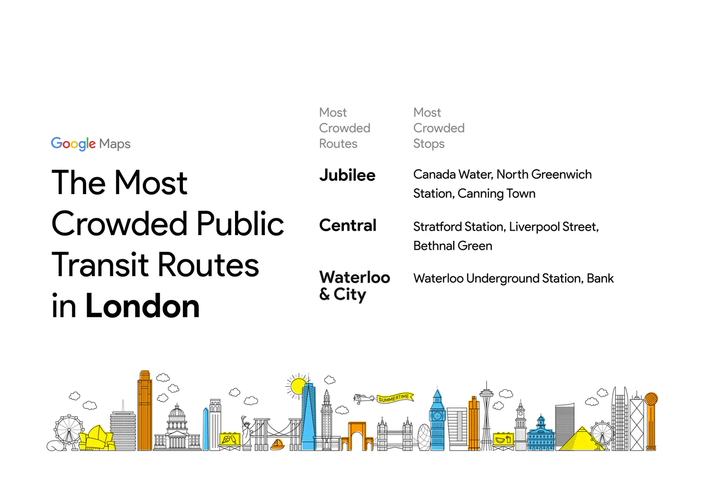
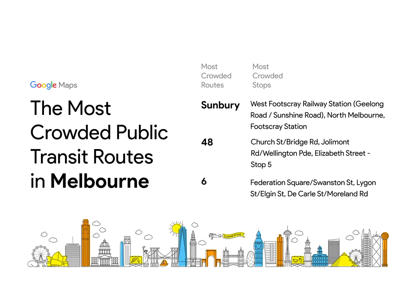
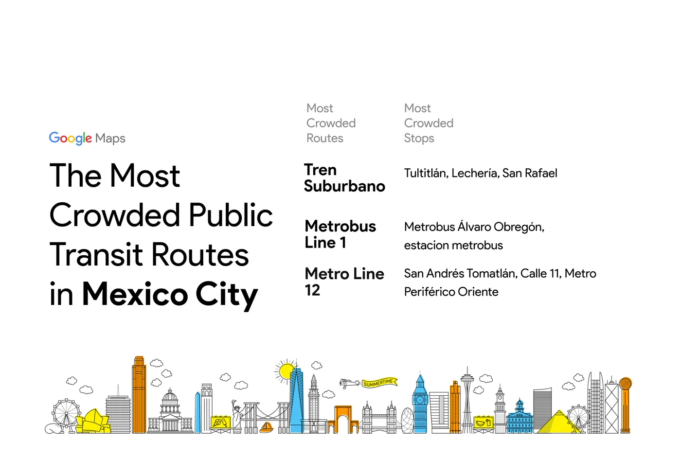
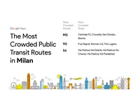
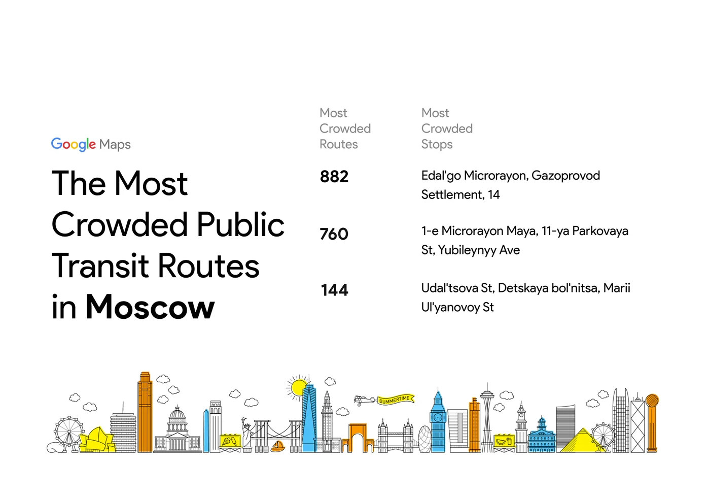
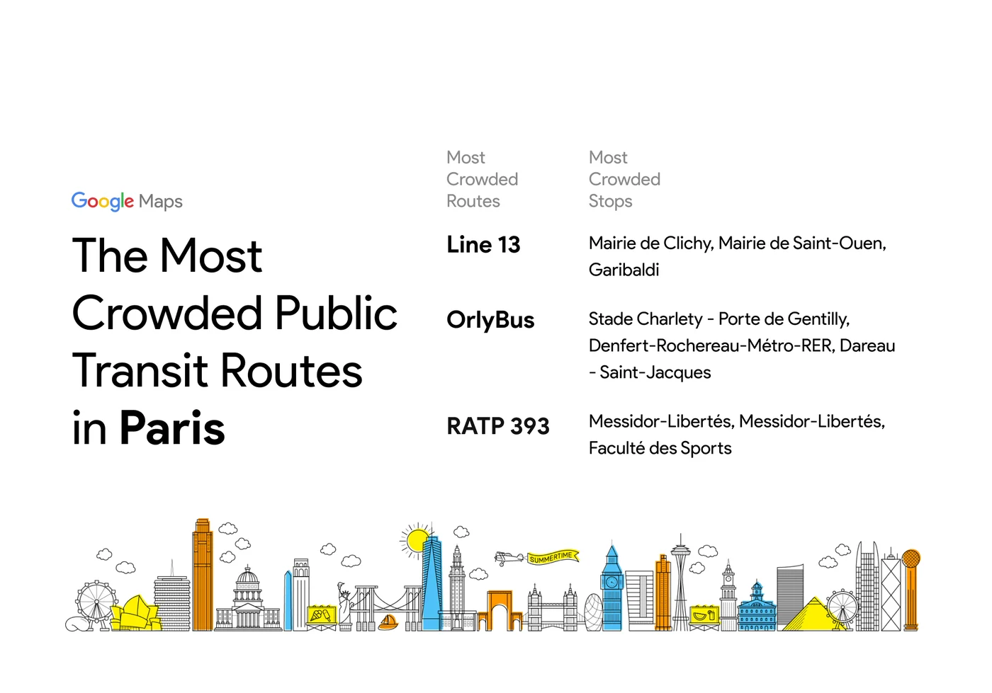
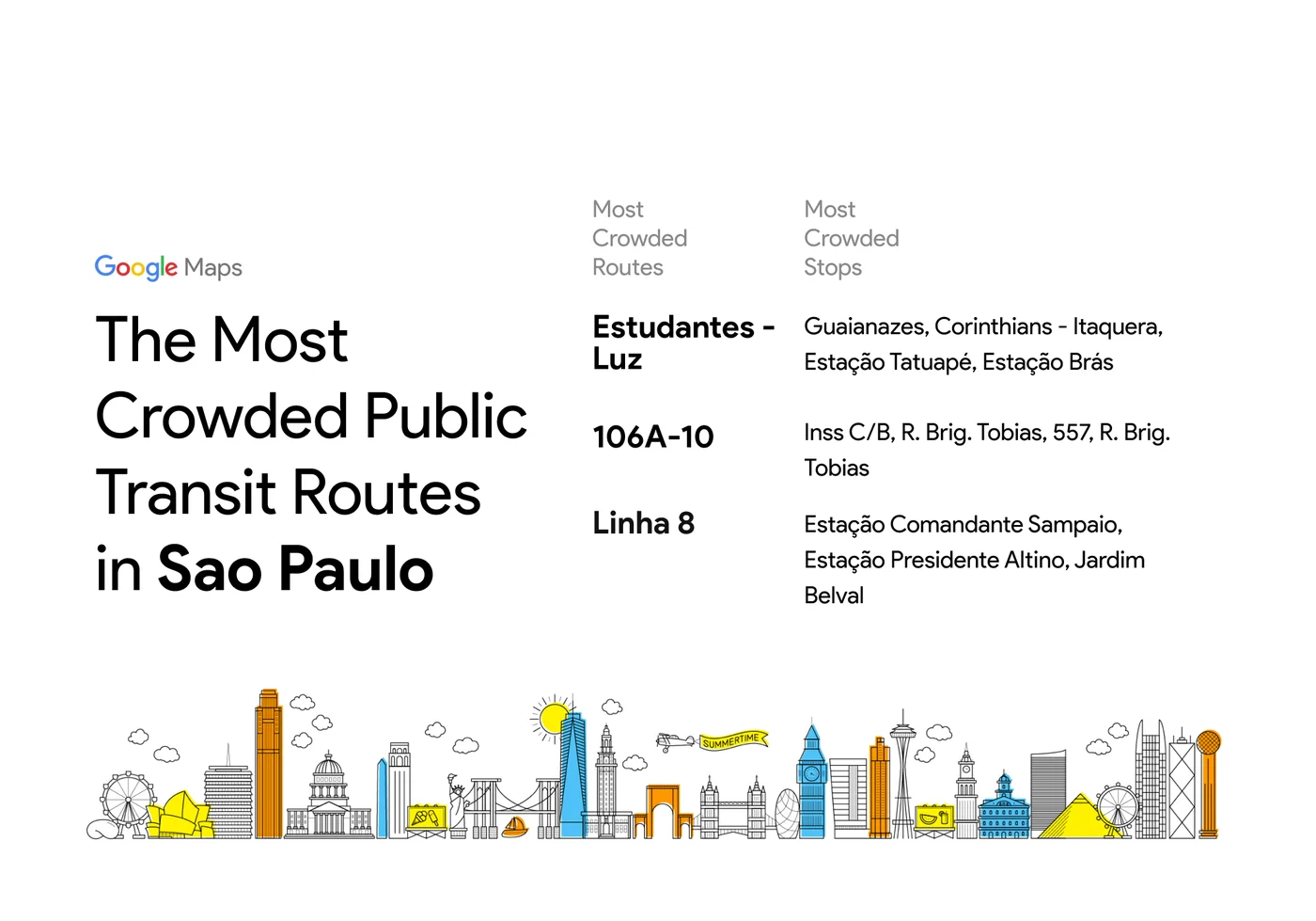
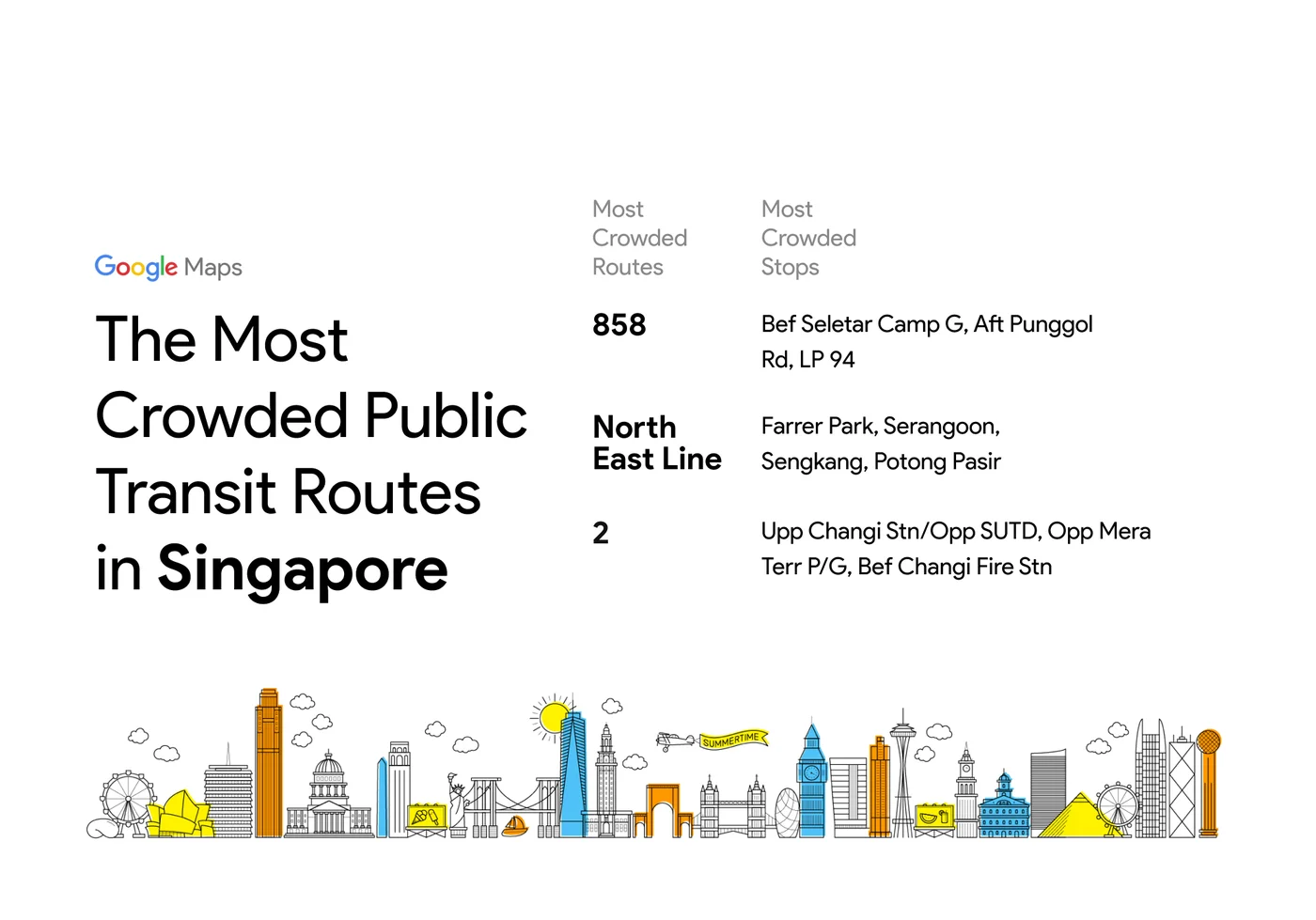
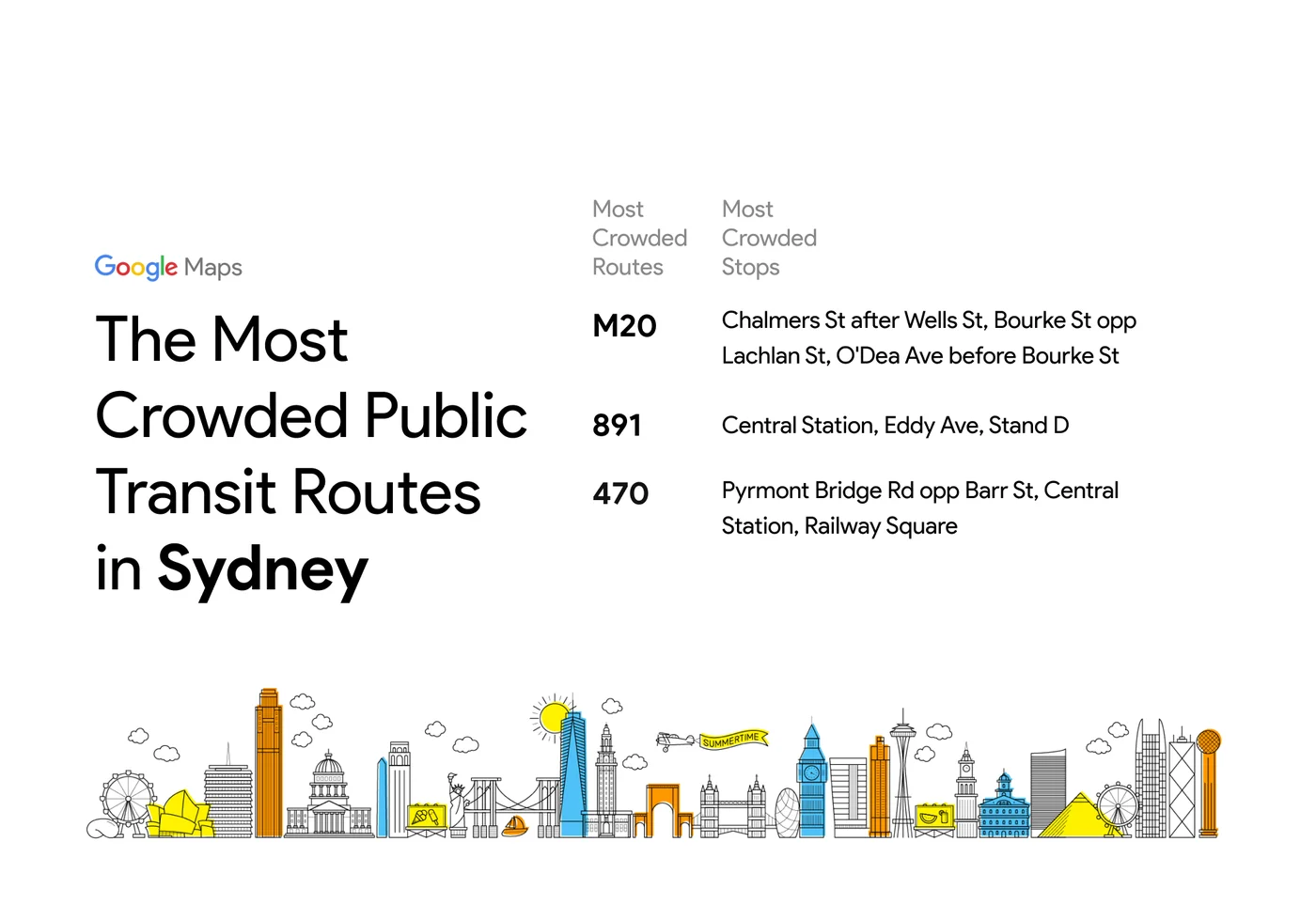
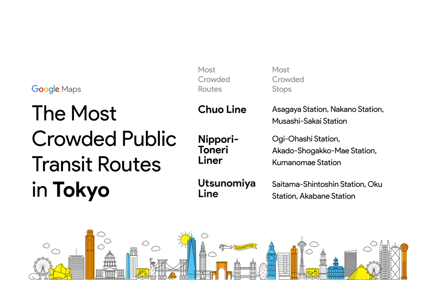
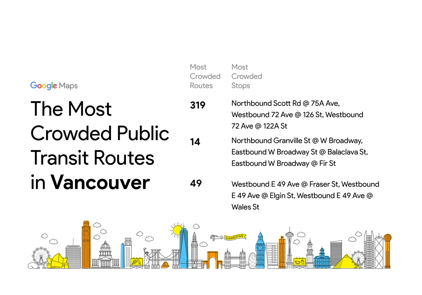
Crowdedness predictions come from optional feedback directly from the people who use Google Maps. In fact, you may have received notifications asking about how crowded your subway, train, or bus ride was after navigating in transit mode. To learn more about how crowdedness levels vary around the world, we analyzed aggregated and anonymized reports of crowdedness from Google Maps users from October 2018 to June 2019 during peak commuting hours (6am - 10am), and identified which lines had the highest number of crowdedness reports. Here’s what we found:
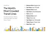
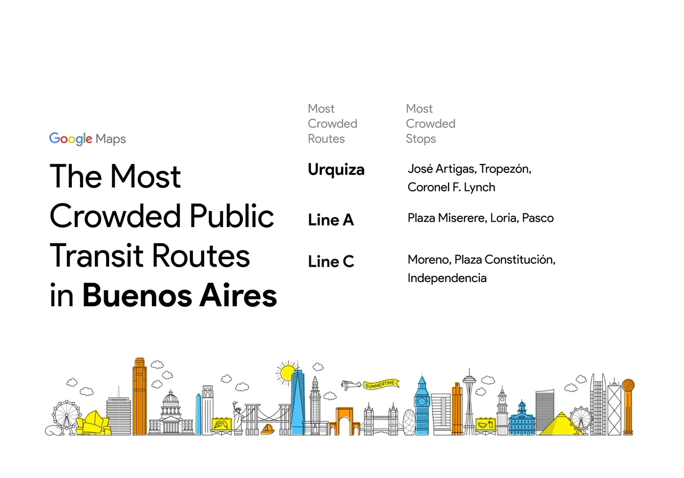
When it comes to the most-crowded transit lines, Buenos Aires and Sao Paulo dominate the rankings–each city has 3 lines in the top 10.
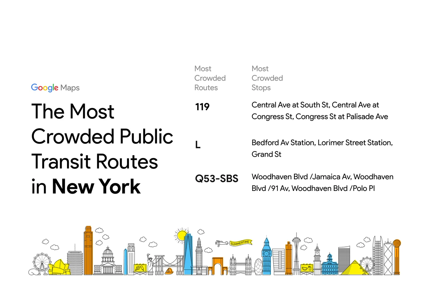
New York’s famed L train–which, until recently, was on the verge of closing for repair– is the only U.S. transit line to make it into the top 10.
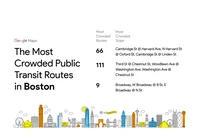
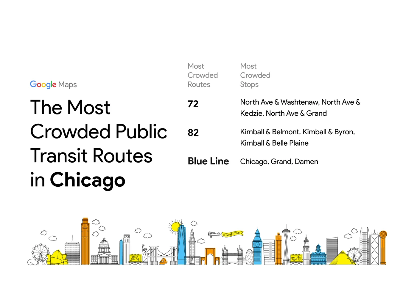
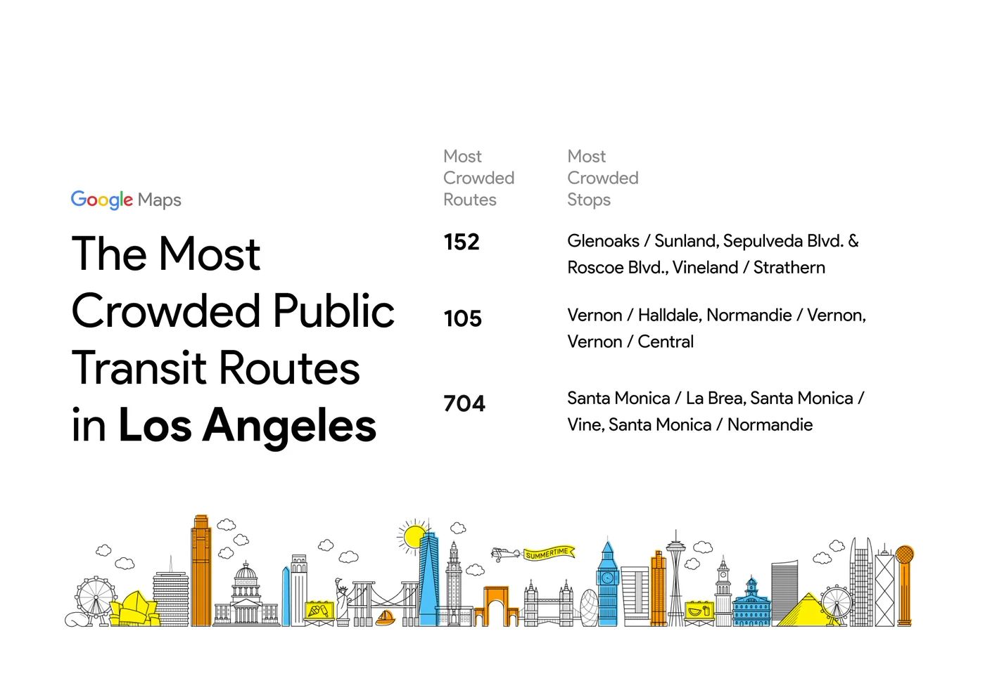
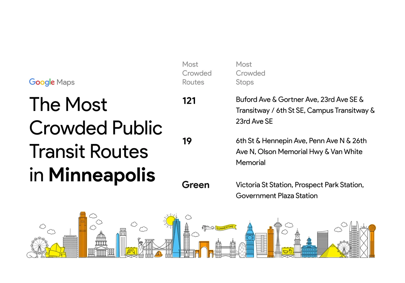
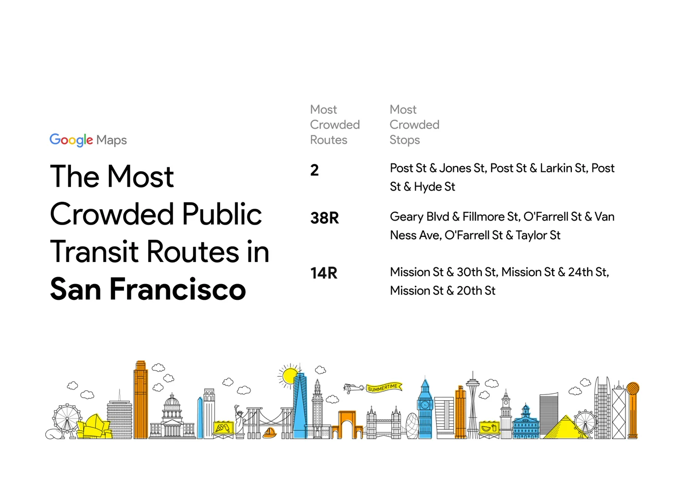
Among many U.S. cities, the most-crowded public transit routes are buses. In Los Angeles, for example, bus routes 152, 105, and 704 are among the most-crowded.