Cheers to Street View’s 10th birthday!
Street View started out as Larry Page’s far-fetched idea to create a 360-degree map of the world. Today, 10 years after the first imagery was published in Street View, people can scale mountains, dive into the depths of the ocean, scout out ramen spots, and walk through museums in far corners of the world. Over the last decade, a lot has changed—the technology we use, the appearance of the planet—but the goal of Google Maps has remained the same: to help you navigate and discover new corners of the world. Now raise your glass (or smartphone), and cheers to Street View’s 10th birthday!


Let’s hop inside our time machine and see where it all began. Larry kicked off the first prototype in 2004 with a team of Googlers who were passionate about his idea to create a 360-degree view of the world. They tossed cameras on a van, added some lasers (okay maybe it was a bit more complicated than that), and the first Street View car was born. In 2006, Street View officially hit the roads in a few cities across the U.S. and the first imagery was published in May 2007. Ten years later, we’ve published imagery on every continent, in 83 countries, and traveled millions of miles with the Street View car. Talk about a roadtrip.
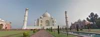
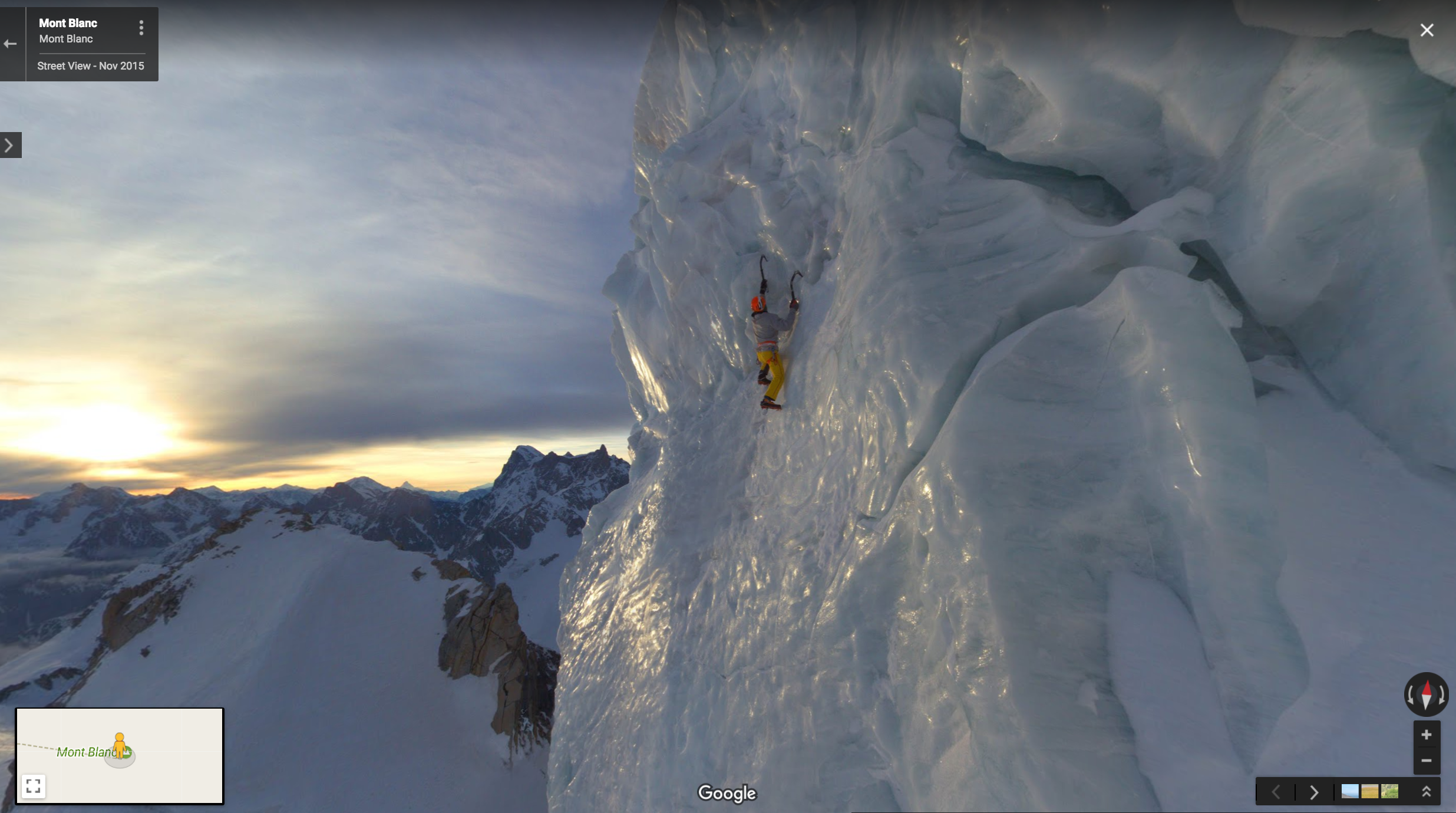
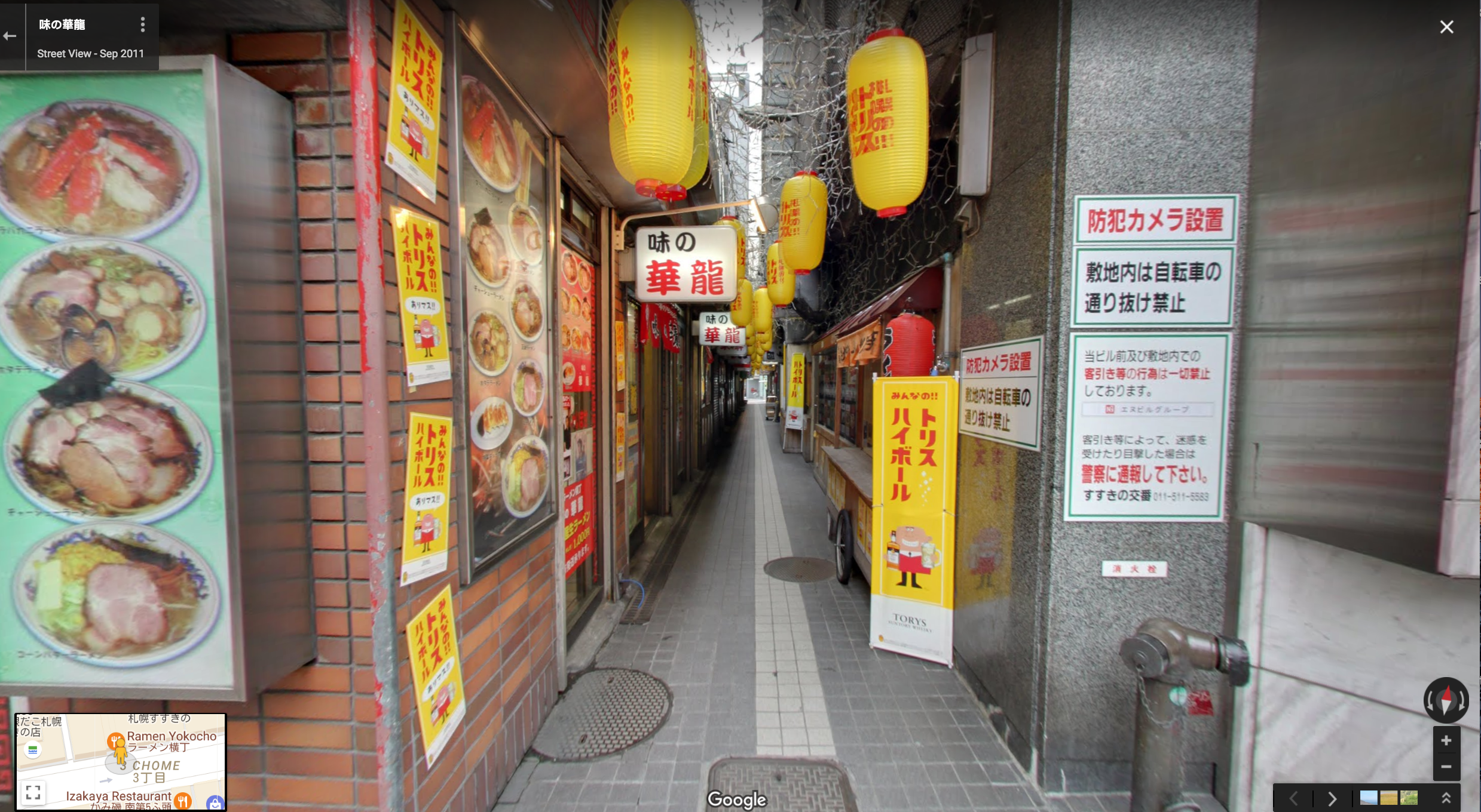
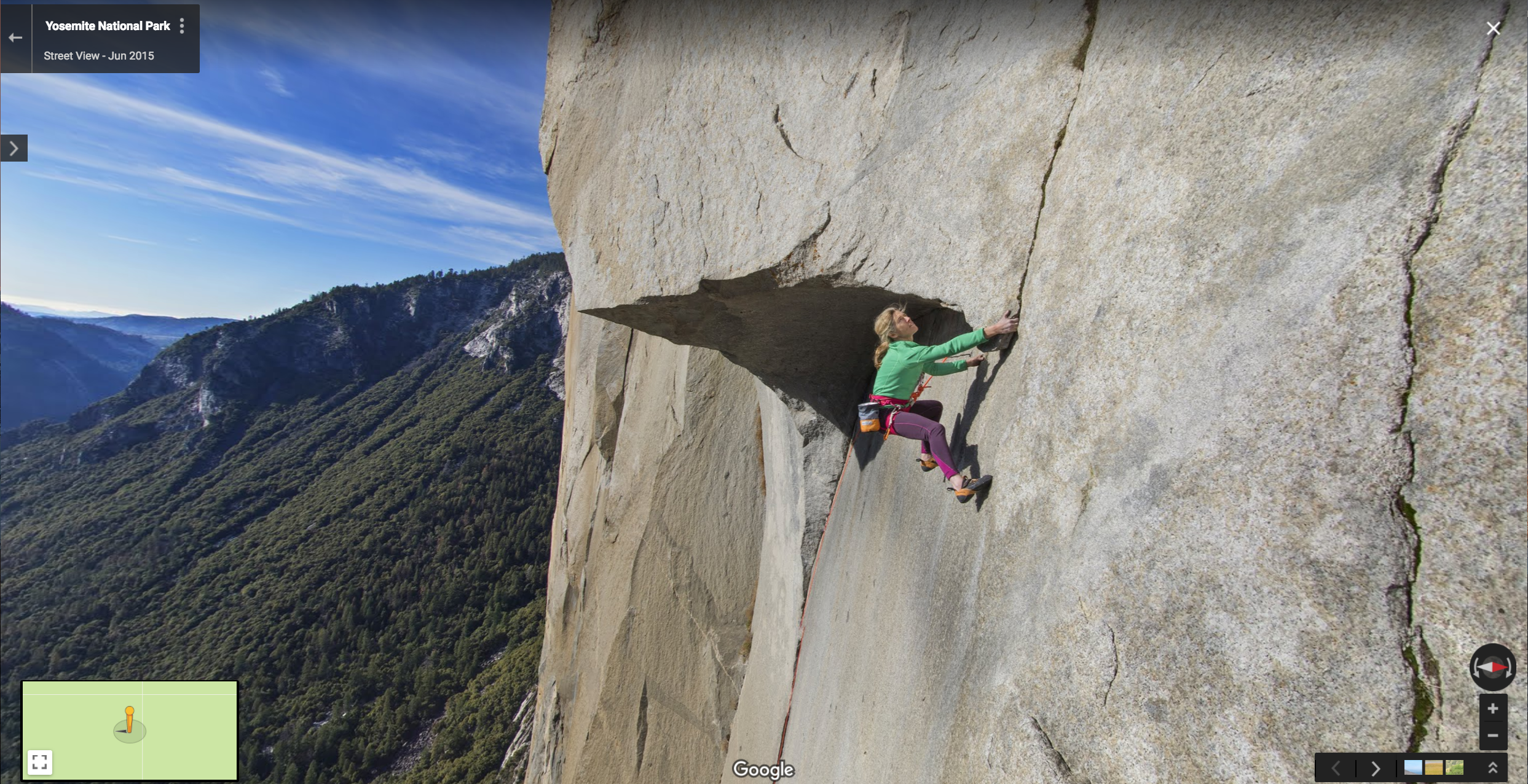
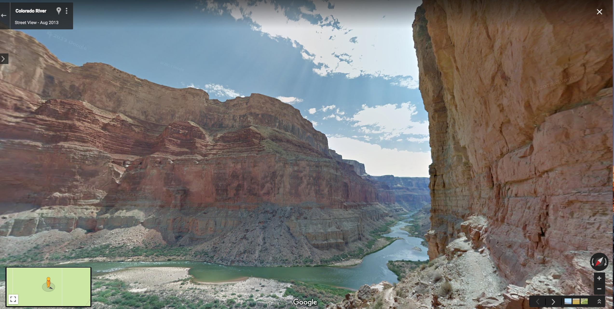
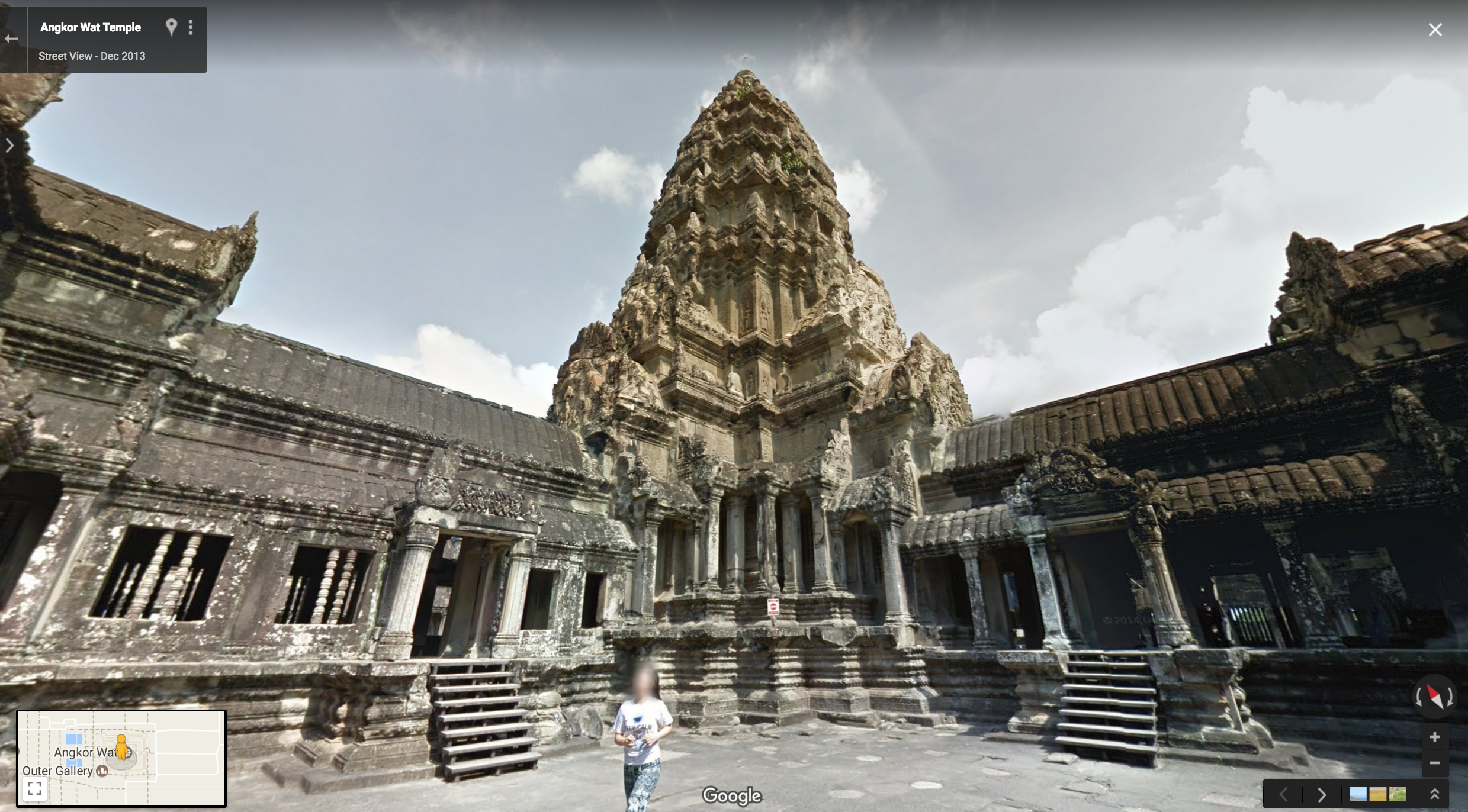
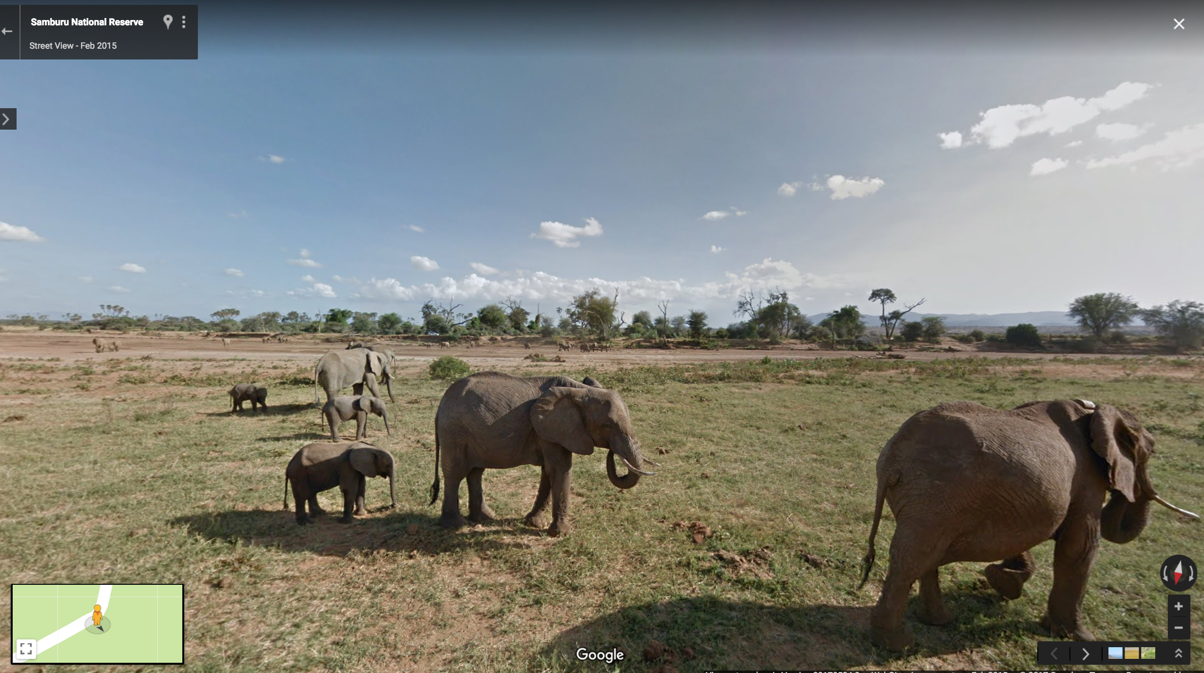
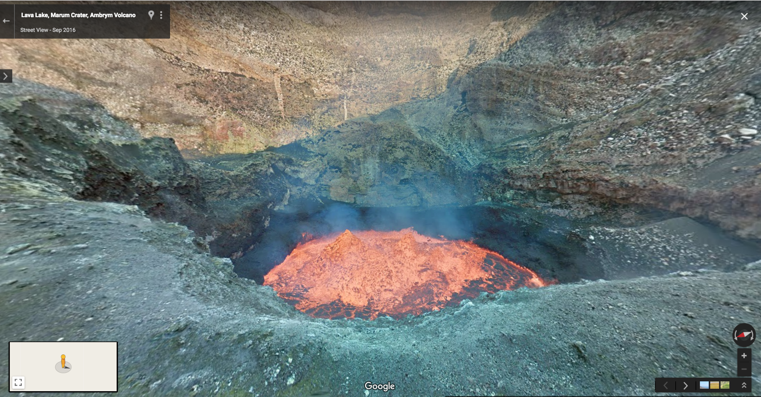
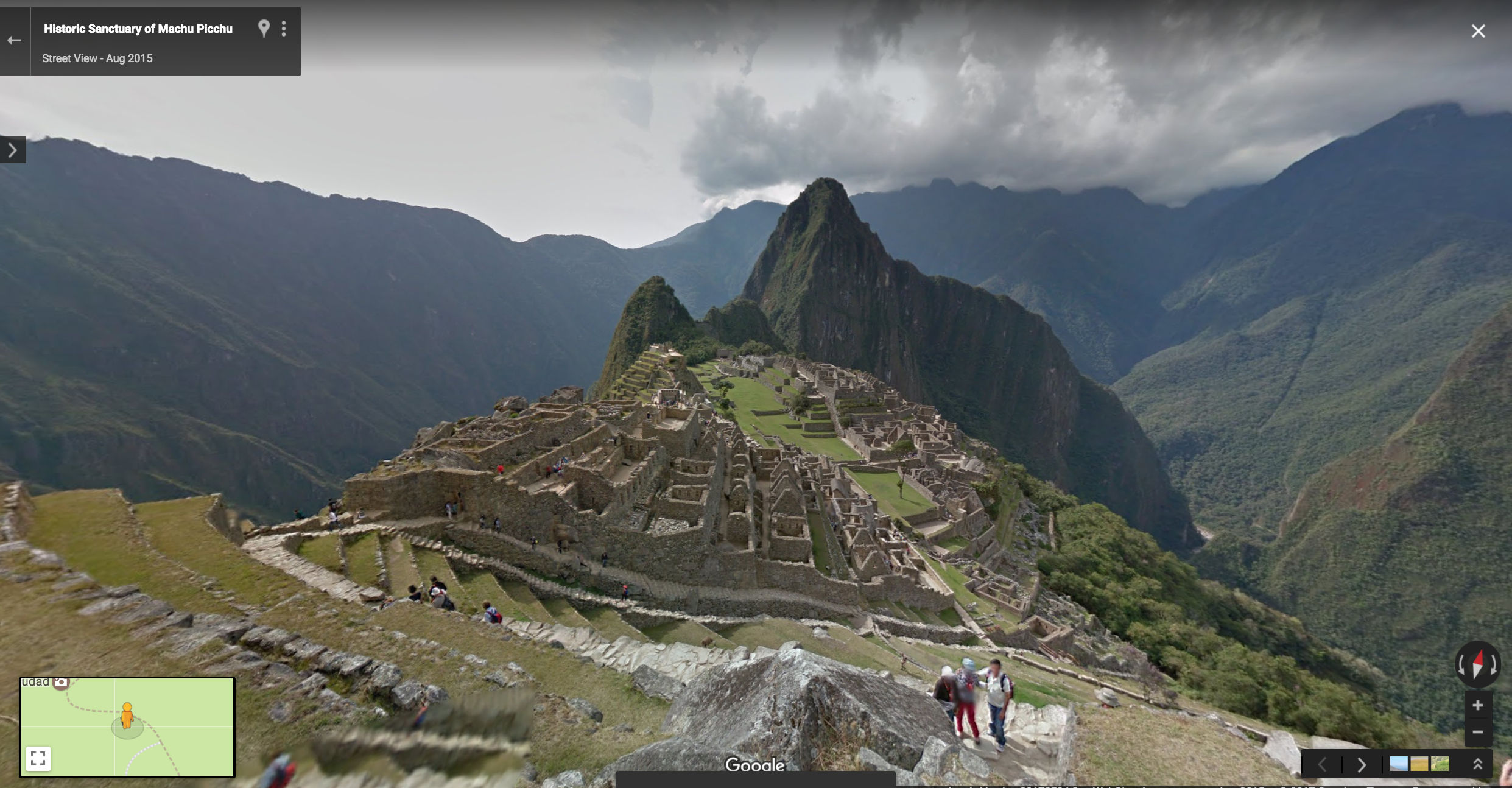
While our cars explored streets around the world, we were still missing out on some of the most beautiful places on Earth: the world that exists beyond the roads. So we developed custom vehicles, like the Street View Trekker, to go where cars couldn’t go. The Trekker is designed to be worn and walked through narrow alleyways or trails, gathering images as it goes. Its traveled to breathtaking natural wonders and world heritage sites—Grand Canyon, the Taj Mahal, Angkor Wat, the Galapagos Islands and even the historic pedestrian paths in Venice. And it's been used by conservation organizations to observe wildlife, like elephants, chimps, polar bears, and frogs in the Amazon, in their natural habitat. Over the years we've put Street View cameras on a snowmobile to bring you closer to the Arctic Eiders, the back of a camel to roam the Arabian desert, and a trolley to give you a better view of renowned works of art.


To build our map of the world faster, in 2013 we enlisted the help of partners through the Trekker Loan Program. We gave volunteers Street View cameras, which they used to collect 360-degree imagery of the local places they know best. Then the Street View App came along in 2015, so that anyone could publish photo spheres (360-degree panoramas) of their favorite places from around the world—or around the block—to Google Maps in an instant. We expanded on this last month, when we announced more than 20 new Street View-compatible 360 cameras, to help you document your adventures with high quality imagery. Now anyone—from tourism organizations to local neighborhood enthusiast—can contribute panoramic imagery to Street View.
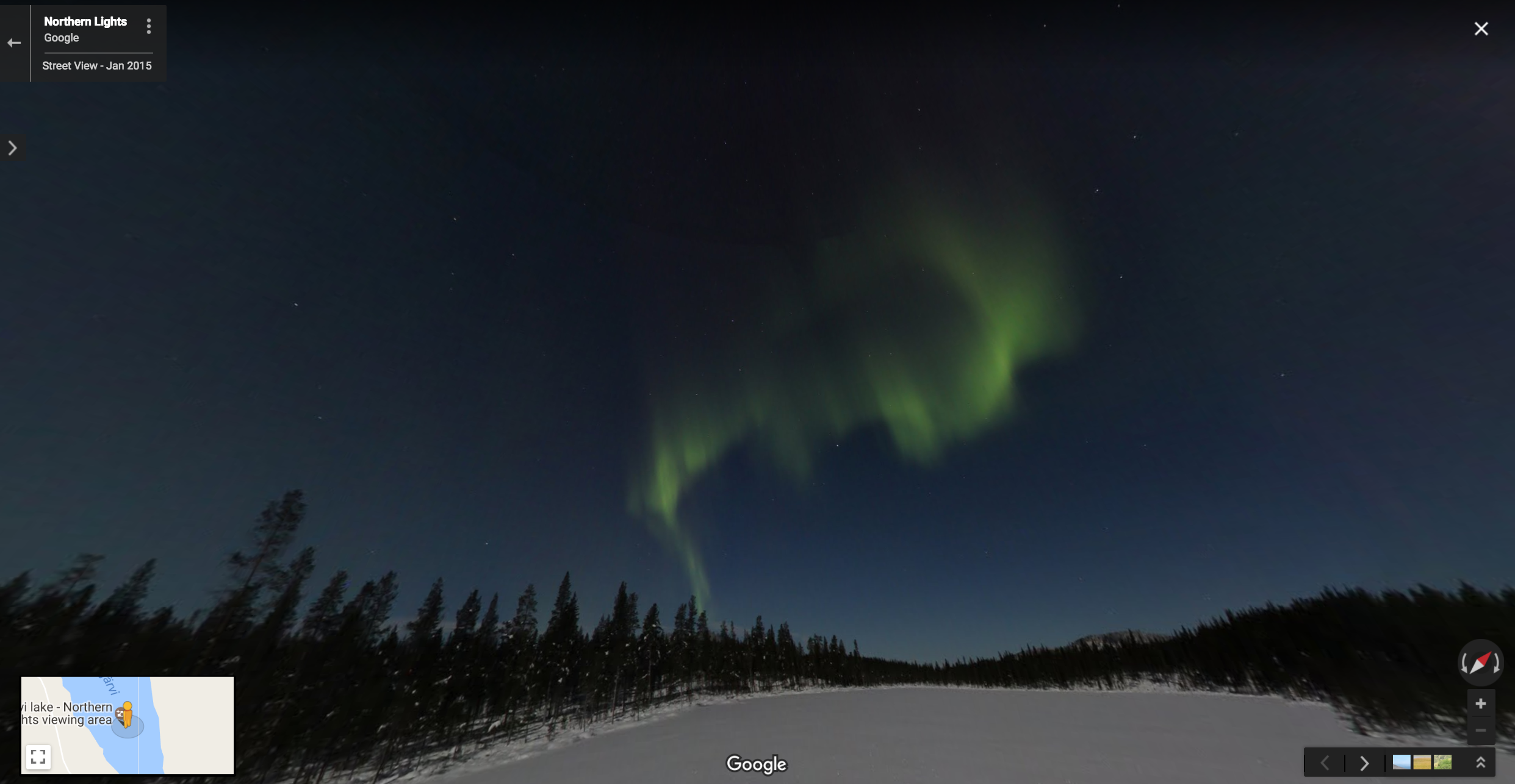
Over the years we’ve learned that the possibilities for Street View are endless. Here are a few of our favorite spots:


The world is better explored than explained. Street View gives you a taste of the places you’ll see in person one day, helps you remember the places you've been, and enables you to explore the places you might never get to. So pick up your phone and take a peek. Many wonders await.