Using AI to find where the wild things are
According to the World Wildlife Fund, vertebrate populations have shrunk an average of 60 percent since the 1970s. And a recent UN global assessment found that we’re at risk of losing one million species to extinction, many of which may become extinct within the next decade.
To better protect wildlife, seven organizations, led by Conservation International, and Google have mapped more than 4.5 million animals in the wild using photos taken from motion-activated cameras known as camera traps. The photos are all part of Wildlife Insights, an AI-enabled, Google Cloud-based platform that streamlines conservation monitoring by speeding up camera trap photo analysis.
With photos and aggregated data available for the world to see, people can change the way protected areas are managed, empower local communities in conservation, and bring the best data closer to conservationists and decision makers.
Ferreting out insights from mountains of data
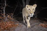
Camera traps help researchers assess the health of wildlife species, especially those that are reclusive and rare. Worldwide, biologists and land managers place motion-triggered cameras in forests and wilderness areas to monitor species, snapping millions of photos a year.
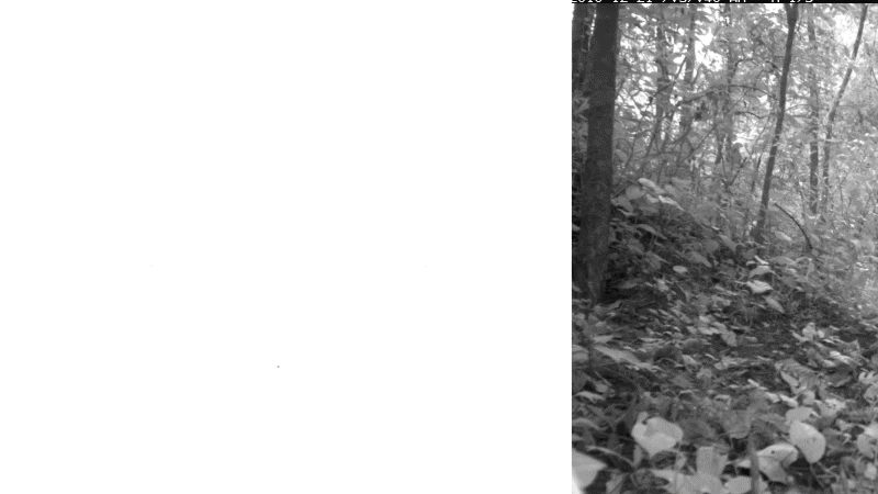
But what do you do when you have millions of wildlife selfies to sort through? On top of that, how do you quickly process photos where animals are difficult to find, like when an animal is in the dark or hiding behind a bush? And how do you quickly sort through up to 80 percent of photos that have no wildlife at all because the camera trap was triggered by the elements, like grass blowing in the wind?
Processing all these photos isn’t only time consuming and painstaking. For decades, one of the biggest challenges has been simply collecting them. Today, millions of camera trap photos languish on the hard drives and discs of individuals and organizations worldwide.
Illuminating the natural world with AI
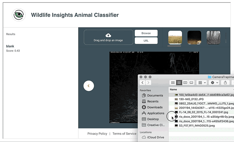
With Wildlife Insights, conservation scientists with camera trap photos can now upload their images to Google Cloud and run Google’s species identification AI models over the images, collaborate with others, visualize wildlife on a map and develop insights on species population health.
It’s the largest and most diverse public camera-trap database in the world that allows people to explore millions of camera-trap images, and filter images by species, country and year.
Seven leading conservation organizations and Google released Wildlife Insights to better protect wildlife.
On average, human experts can label 300 to 1,000 images per hour. With the help of Google AI Platform Predictions, Wildlife Insights can classify the same images up to 3,000 times faster, analyzing 3.6 million photos an hour. To make this possible, we trained an AI model to automatically classify species in an image using Google’s open source TensorFlow framework.
Even though species identification can be a challenging task for AI, across the 614 species that Google’s AI models have been trained on, species like jaguars, white-lipped peccaries and African elephants have between an 80 to 98.6 percent probability of being correctly predicted. Most importantly, images detected to contain no animals with a very high confidence are removed automatically, freeing biologists to do science instead of looking at empty images of blowing grass.
With this data, managers of protected areas or anti-poaching programs can gauge the health of specific species, and local governments can use data to inform policies and create conservation measures.
The Wildlife Insights Animal Classifier tool helps researchers classify 614 species.
Acting before it’s too late
Thanks to the combination of advanced technology, data sharing, partnerships and science-based analytics, we have a chance to bend the curve of species decline.
While we’re just at the beginning of applying AI to better understand wildlife from sensors in the field, solutions like Wildlife Insights can help us protect our planet so that future generations can live in a world teeming with wildlife.
Learn more about Wildlife Insights and watch the documentary film Eyes in the Forest: Saving Wildlife In Colombia Using Camera Traps and AI. The film tells the story of a camera trapper who uses Wildlife Insights to document and preserve the biological diversity in Caño Cristales, a reserve in Colombia’s remote upper Amazon region.
Wildlife Insights is a collaboration between Conservation International, Smithsonian’s National Zoo and Conservation Biology Institute, North Carolina Museum of Natural Sciences, Map of Life, World Wide Fund for Nature, Wildlife Conservation Society, Zoological Society of London, Google Earth Outreach, built by Vizzuality, and supported by the Gordon and Betty Moore Foundation and Lyda Hill Philanthropies.


